
Length: 34 Miles
Direction: Clockwise
Elevation Gain: 1231 ft
Highest Point: 287 ft
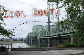
This 34 mile ride crosses the mighty Columbia River twice as you travel into Washington State to Vancouver and home again near Camas. The bridge crossings really set this ride apart from other options. Both bridges are major thoroughfares including the Interstate 5 heading north and the Interstate 205 southbound. However, being such a friendly cycling area, the bridges are easy to navigate and you are not crossing in traffic. In fact, you can take a little time to enjoy the view over the river as you go.
It is interesting how much wider the Columbia gets at the I-205. Whereas one can cross the I-5 in about 2 minutes, the 205 path is more in the range of 2 miles! What is also unique is that the path is in the middle of the north and southbound lanes. You may find it a bit noisy, but it is an interesting experience taking this route.
The Border Crossing ride is easily negotiated in both directions, but the route planners recommends going clockwise: the I-205 bridge is mostly downhill heading southbound. When the wind is whipping through the gorge, you’ll gently coast down the 205 path; while commuters struggle past in the opposite direction, you can give yourself a pat on the back for having chosen clockwise yet again.
In between the bridges on the Washington side is a lovely portion of Vancouver. Officer’s Row is filled with historic restored homes to the left and a park to your right. When you’re back in Oregon, enjoy the quiet streets of Maywood Park. This city fought the development of the I-205, which cut through the heart of the town. But the residents have preserved the neighborly attitude and goodwill that has always been a part of the area.
This route comes to us courtesy of Rubber to the Road, the longstanding resource for interesting routes.